


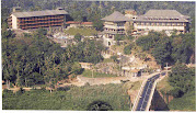
SRI LANKA HOLIDAYS: SAVE OUR PENINSULA
bunpeiris ( B. UPUL N. PEIRIS), Moratuwa
May all beings everywhere plagued with sufferings of body and mind quickly be freed from their illnesses.
May those frightened cease to be afraid,
and may those bound be free.
May the powerless find power,
and may people think of befriending
one another.
May those who find themselves in trackless,
fearful wilderness--
the children, the aged, the unprotected--
be guarded by beneficent celestials,
and may they swiftly attain Buddhahood.
Buddha
May all terrorists get cured of their common sickness, their common malady
INDIA'S UNILATERAL , ILLEGAL, ANTI-ENVIRONMENT, ANTI-ETHICAL PROJECT TO DREDGE PALK STRAIT TO ITS OWN ADVANTAGE & TO THE KILLER DETRIMENT OF ITS NEIGHBOUR SMALL ISLAND ACROSS THE 30KM PALK STRAIT, SRI LANKA
Once the The Sethu Samudram Canal is completed the Jaffna Peneinsula (99% Tamils, No Sinhalese) of the small (25,000 sq.miles)
Quote Marine Pollution Bulletin
Volume 56, Issue 2, February 2008, Pages 170-186
The Sethu Samudram Canal Project (SSCP), considered as a harbinger of economic growth in India, is a mega engineering project being developed to provide a 260 km long, 300 m wide and 12 m deep shipping channel between the Arabian Sea and the Bay of Bengal. This project impacts the unique biota and biodiversity of a 10,500 km2 Marine Biosphere Reserve. This man-made link facilitates exchange of water masses between the less saline Bay of Bengal and the more saline Arabian Sea. Initial construction, subsequent dredging for channel maintenance, and the associated ship traffic would result in irreversible changes to the already over-exploited and stressed environment. Additionally, the channel would form a deep ocean route for future tsunamis. However, to provide assurance to the public, particularly the 50,000 fishing folk, in 47 villages in this area, it would be crucial that a long-term environmental monitoring program is instituted. A thorough evaluation of the impending environmental impacts, similar to those addressed by a Before/After and Control/Impact (BACI model) is recommended.
Unquote Marine Pollution Bulletin
Volume 56, Issue 2, February 2008, Pages 170-186
Impending Total destruction of ADAM'S BRIDGE (Ram Setu )
A detail on the location of Rama Setu is relevant. The Rama Setu is 3 to 5 kms. wide and 35 kms. long and links Dhanushkodi and Talaimannar. Rama Setu is seen today as a series of sandbanks (thidal in Tamil) interspersed with incursion of the ocean breaking up the sandbanks in shallow depths from 3 to 9 feet. The tides of the Indian ocean ingress and retreat. During times of low-tides, the entire stretch of the Rama Setu becomes visible as a land connection between Dhanushkodi and Talaimannar as was seen during the tsunami day on Dec. 26, 2004. Thus, the depths of water in the spaces between the sandbanks keep varying. Pilgrims even today stand upto 4 feet deep ocean waters and offer pitrutarpanam in this place. Over 5 lakh pilgrims visit on Ashadha amavasya day to do sankalpam in Agni teertham in Rameshwaram and many also journey to the Rama Setu by boats and stand on the Rama Setu and the 4 feet deep ocean waters. This is the locus of Underwater Cultural Heritage, this is Rama Setu mandiram.
SRI LANKA HOLIDAYS: SAVE OUR PENINSULA


0 Comments:
Post a Comment